


Grant Township Voting District, Decatur County, Kansas
About
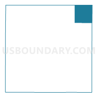
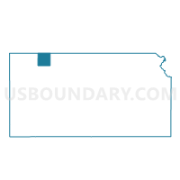
Outline

Summary
| Unique Area Identifier | 584455 |
| Name | Grant Township Voting District |
| County | Decatur County |
| State | Kansas |
| Area (square miles) | 35.66 |
| Land Area (square miles) | 35.63 |
| Water Area (square miles) | 0.03 |
| % of Land Area | 99.93 |
| % of Water Area | 0.07 |
| Latitude of the Internal Point | 39.96061380 |
| Longtitude of the Internal Point | -100.23001060 |
Maps

Graphs
Select a template below for downloading or customizing gragh for Grant Township Voting District, Decatur County, Kansas


Neighbors
Neighoring Voting District (by Name) Neighboring Voting District on the Map
- Beaver Precinct, Red Willow County, NE
- Center Precinct 2, Norton County, KS
- Harlan Township Voting District, Decatur County, KS
- Lincoln Township Voting District, Decatur County, KS
- Roosevelt Township Voting District, Decatur County, KS
- Wilsonville Precinct, Furnas County, NE
Top 10 Neighboring County Subdivision (by Population) Neighboring County Subdivision on the Map
- Center-District 1 township, Norton County, KS (1,393)
- Lincoln township, Decatur County, KS (172)
- Wilsonville precinct, Furnas County, NE (168)
- Lebanon precinct, Red Willow County, NE (113)
- Harlan township, Decatur County, KS (21)
- Roosevelt township, Decatur County, KS (18)
- Grant township, Decatur County, KS (11)
Top 10 Neighboring Unified School District (by Population) Neighboring Unified School District on the Map
Top 10 Neighboring State Legislative District Lower Chamber (by Population) Neighboring State Legislative District Lower Chamber on the Map
Top 10 Neighboring State Legislative District Upper Chamber (by Population) Neighboring State Legislative District Upper Chamber on the Map
Top 10 Neighboring 111th Congressional District (by Population) Neighboring 111th Congressional District on the Map
Top 10 Neighboring Census Tract (by Population) Neighboring Census Tract on the Map
- Census Tract 9517, Norton County, KS (5,671)
- Census Tract 9639, Furnas County, NE (4,959)
- Census Tract 9631, Red Willow County, NE (2,708)
- Census Tract 9511, Decatur County, KS (1,104)